Originally published in Lake of the Woods Area News, Volume 55, Number 4, Fall 2025
Put a plan in place. Ensure there’s enough science and management expertise.Coordinate actions bi-nationally. That’s our mission.
The International Multi-Agency Arrangement (IMA) is a cooperative, collaborative network of federal, state, provincial and Indigenous government agencies in the Rainy-Lake of the Woods watershed. The IMA launched in 2009 with nine initial signatories working together across the border to help enhance and restore water quality in the watershed, according to each agency’s respective mission.
In addition to the management work group, a Technical Advisory Committee (TAC) pulls in the expertise of field and technical personnel from agencies who have mandates that align with the purpose of the IMA. Today, more than 30 agencies and groups participate in the IMA and IMA-TAC.
Over the years, the TAC has had several subcommittees focused on specific projects and activities. In 2025, the three TAC subcommittees study Aquatic Invasive Species; Water Quality, Nutrients and Contaminants; and Core Monitoring—the subject of this article.
“Core” monitoring refers to the minimum essential monitoring program required to ensure sufficient data is collected across the watershed for managers to be able to reliably assess aquatic ecosystem health. Through the IMA, groups achieve consensus around the priority water quality goals, while simultaneously pursuing their own priorities (often mandated in legislation or regulation), field and lab protocols, and regions of focus.
Last year, the IMA members agreed on a set of highest concerns for Rainy-Lake of the Woods and these became the ‘alert levels’ adopted by the International Rainy-Lake of the Woods Watershed Board (IRLWWB) in late summer 2024. Currently, there are alert levels across Lake of the Woods, Rainy River, and other boundary waters for phosphorus (a nutrient of concern that drives algae blooms), cyanotoxins (liver and nerve toxins produced by blue-green algae), and mercury in fish.
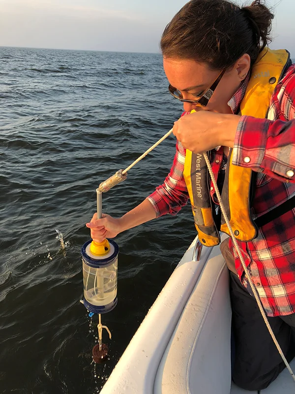
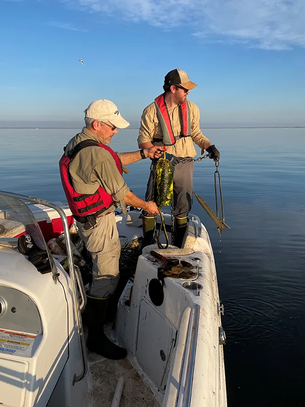
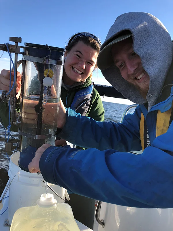
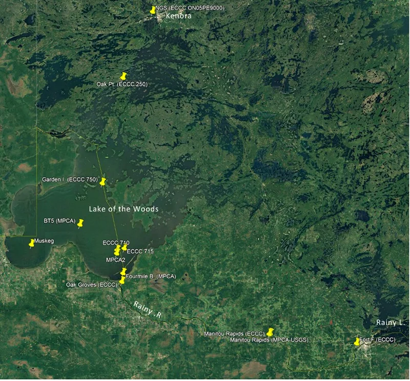
The agencies that routinely do water quality monitoring in the watershed comprise the IMA core monitoring group. These partners collect water quality data on parameters used to establish baseline levels of water quality and to assess alert levels and other concerns. Water is sampled from sites along the Rainy River and its tributaries, and throughout Lake of the Woods to its outflow at the Norman Generating Station in Kenora. These data are shared with the IRLWWB, who assesses whether alert levels are being exceeded, and if so, what actions are needed to address the exceedances. The data can also help to identify new, emerging or escalating concerns so that governments can act swiftly.
A core monitoring program for Rainy-Lake of the Woods has been under consideration for at least 15 years. When the IRLWWB launched in 2013, among its first tasks was to identify priority water quality studies. More than 30 such projects were identified, and a proposed core monitoring program was the backbone for all of them. Despite the clear consensus on the need for the program, it has taken until 2025 to launch the initiative because it is an extremely complicated, multijurisdictional undertaking that requires dedicated interagency coordination, funding commitments, agreements to cooperate, and trust among parties. In the past few years, LOWWSF has focused on providing that interagency coordination and facilitation to help bring the core monitoring program to fruition this year.
Rather than being a stand-alone program funded and coordinated by any one party or group of parties, the core monitoring program is made possible by leveraging the day-to-day work done by agency partners, with LOWWSF helping to coordinate the exchange of information, planning, and program delivery among the partners.
This is one of the most vital services LOWWSF plays: as a non-profit mandated to do international coordination at arm’s length from government, we have the unique ability to invite stakeholders and rightsholders to our table where we facilitate discussions among parties who may not otherwise be able to easily communicate directly with one another across international boundaries or agency silos. We help partners to identify needs, fill capacity gaps, and work collaboratively to achieve what single agencies cannot do alone.
Here’s what this looks like in practice.
The Red Lake Nation (Red Lake Band of Chippewa), one of the IMA partners, has traditional territory in the Northwest Angle and Big Traverse Bay at the south end of Lake of the Woods. As part of their cultural and natural heritage restoration program to rehabilitate streams and restore wild rice beds, the nation does regular water quality sampling on the open waters of Big Traverse Bay during the summer. Their work is supported with technical expertise from the Science Museum of Minnesota’s St Croix Watershed Research Station and through the United States Environmental Protection Agency (also members of the IMA). At the same time, Environment and Climate Change Canada (ECCC) conducts an annual open water survey at more than two dozen sites throughout Lake of the Woods each summer, while Grand Council Treaty #3 (GCT3) does high-frequency remote sensing and community-based monitoring at sites throughout the Canadian side of the watershed. Various study teams, both academic and governmental, also conduct periodic or episodic monitoring in different parts of the watershed.
LOWWSF convenes these IMA partners throughout the year to ensure that among all groups, water quality is being sampled at key locations through the main flow channel between Rainy Lake, down the Rainy River, through the south and north basins of Lake of the Woods, and through the outflow at Norman.
To be sure that different agencies’ techniques deliver comparable results, agencies do joint sampling and processing tests from time to time. Agencies choose dates and locations when they can simultaneously collect data side by side, each taking multiple samples and sharing them with other teams for processing in their respective labs, so that we can determine the variability between labs or sampling methodologies.
This year, the program is running from May through October. Most agencies publish data publicly, and all agencies’ core monitoring program data inform the annual IRLWWB Water Quality Exceedance Report, available online at ijc.org/en/rlwwb.